The Future of Drone Surveying in Nepal
Sagar Kandel
October 24, 2026 • 5 min read
Nepal is defined by its breathtaking, rugged topography. While the Himalayas and the steep hills provide an unmatched natural beauty, they pose a formidable challenge for civil engineering and infrastructure development. Traditional surveying methods—often relying on theodolites, total stations, and manual terrain trekking—are not just time-consuming; in many parts of the country, they are genuinely hazardous.
Enter Unmanned Aerial Vehicles (UAVs), more commonly known as drones. In recent years, the adoption of drone photogrammetry in Nepal has begun shifting from a luxury technological novelty to an absolute necessity in modern engineering planning.
The Topographical Challenge
Conducting a preliminary survey for a new highway alignment or a hydropower project in rural Nepal historically required weeks of groundwork. Survey teams faced steep inclines, dense forests, and unpredictable weather, drastically slowing down project timelines and driving up preliminary costs.
"What used to take a team of five surveyors two weeks to measure manually can now be mapped in a single morning flight with centimeter-level accuracy."
Rise of Photogrammetry and Digital Twins
The magic of drone surveying isn't just in the flying camera—it’s in the data processing. Software like AutoCAD paired with photogrammetry engines (such as Agisoft Metashape or Pix4D) allow us to stitch together thousands of high-resolution aerial photographs into highly accurate 3D point clouds and orthomosaic maps.
By creating these "Digital Twins," engineers can conduct highly detailed structural and terrain analyses from their desks. We can calculate cut-and-fill volumes, monitor landslide-prone zones safely from a distance, and integrate models directly into BIM (Building Information Modeling) workflows.
Precision from Above: Drone Mapping the Historic BaghBhairab Temple
The intersection of historic preservation and modern structural engineering requires highly accurate data. To extract precise architectural dimensions of the BaghBhairab Temple for structural analysis, I conducted a comprehensive drone photogrammetry project. This allowed me to bridge the gap between field data acquisition and advanced computational modeling.
Project Overview & Equipment
The primary goal of this project was to generate a high-fidelity 3D model and extract exact architectural measurements of the temple to facilitate finite element analysis.
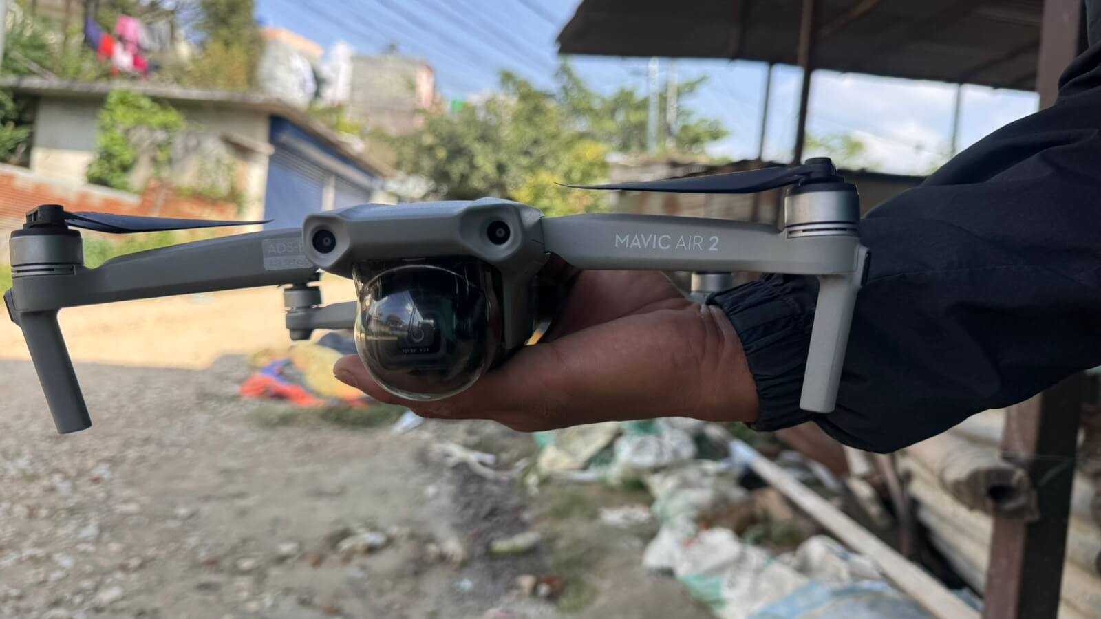
- Hardware: DJI Mavic Air 2 Drone
- Software: Agisoft Metashape Pro (Version 1.5.1)
- Target Application: Structural analysis using Abaqus
- Key Deliverables: 3D Mesh, High-resolution Digital Elevation Model (DEM), and Orthomosaic.
Methodology: From Flight to 3D Model
The photogrammetry workflow required careful planning, both in the physical flight execution and the digital processing environment, to ensure structural-grade accuracy.
1. Data Acquisition (The Flight)
To capture the intricate details of the temple's multi-tiered architecture, I piloted the DJI Mavic Air 2 to capture a comprehensive dataset. The flight plan was designed to capture both Nadir (straight down) and Oblique (angled) images. Shooting in RAW format was critical here, as it maximized the dynamic range and preserved the fine textural details of the masonry and woodwork necessary for the software to identify tie points.

2. Image Processing in Agisoft Metashape
Once the RAW images were collected, the processing phase began in Agisoft Metashape Pro.
- Image Alignment & Camera Optimization: The first step involved aligning the overlapping images to generate a sparse point cloud. Metashape's camera optimization algorithms were utilized to refine the internal and external camera orientation parameters, correcting for lens distortion.
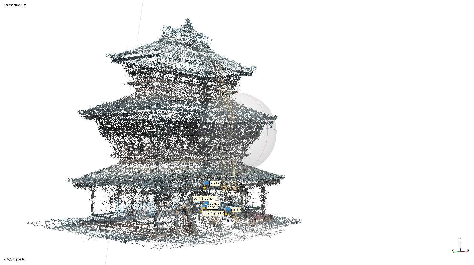
- Precision Scaling: Because this model was intended for structural analysis, arbitrary scale was unacceptable. To anchor the model in real-world dimensions without relying solely on standard Ground Control Points (GCPs), I utilized 3m and 2m surveying staffs placed strategically around the site. By identifying these known lengths within the Metashape environment, I was able to scale the entire project, achieving a remarkable final scale error of just 2.1 mm.
- Dense Cloud & Mesh Generation: With the space perfectly calibrated, the software computed the depth information for every pixel, resulting in a dense point cloud. This cloud was then meshed to create a solid 3D geometric surface of the temple.
- Generating Orthomosaics and DEMs: Finally, the model was used to project high-resolution Orthomosaics (distortion-free aerial maps) and DEMs, providing precise top-down topographical and dimensional data.
Challenges Conquered
- Preparing for Abaqus (Mesh Decimation): One of the most significant challenges was the sheer density of the raw 3D mesh. High-resolution photogrammetry produces millions of polygons, which is computationally overwhelming for finite element analysis software like Abaqus. I had to strategically perform mesh decimation—reducing the polygon count while rigorously preserving the crucial geometric boundaries and structural corners of the temple.
- Achieving Sub-Centimeter Accuracy: Hitting a 2.1 mm scale error required meticulous placement and identification of the surveying staffs within the images. It tested my patience and precision during the marker placement phase in Metashape.
Conclusion
This project successfully transformed raw aerial photographs into a structurally accurate, millimeter-precise 3D model of the BaghBhairab Temple. By integrating drone piloting, advanced photogrammetry in Metashape, and preparing the resulting data for Abaqus, it highlights the powerful role that reality-capture technology plays in modern civil engineering and historic preservation.
Looking Ahead
As the civil engineering sector in Nepal continues to modernize, the integration of drones will only deepen. We are already seeing the integration of LiDAR scanners on commercial drones, which can penetrate dense jungle canopies to reveal the bare earth beneath—a game changer for the Terai and mid-hill regions.
The future of surveying in Nepal is undeniably airborne. For engineering students and professionals alike, adapting to these digital methodologies is no longer optional; it is the baseline for building the infrastructure of tomorrow.