Drone Photogrammetry & 3D Modeling: BaghBhairab Temple
Sagar Kandel
July 2025 • 4 min read
Tech Stack: DJI Mavic Air 2, Agisoft Metashape Pro, Abaqus
Project Overview
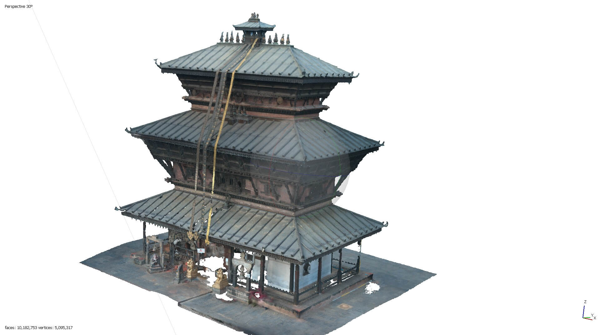
Created a millimeter-accurate 3D structural model of the historic BaghBhairab Temple to bridge field data acquisition with finite element analysis (FEA).
Key Contributions & Methodology
- Data Acquisition: Piloted drone to capture complex architectural geometry using RAW Nadir and Oblique aerial imagery.
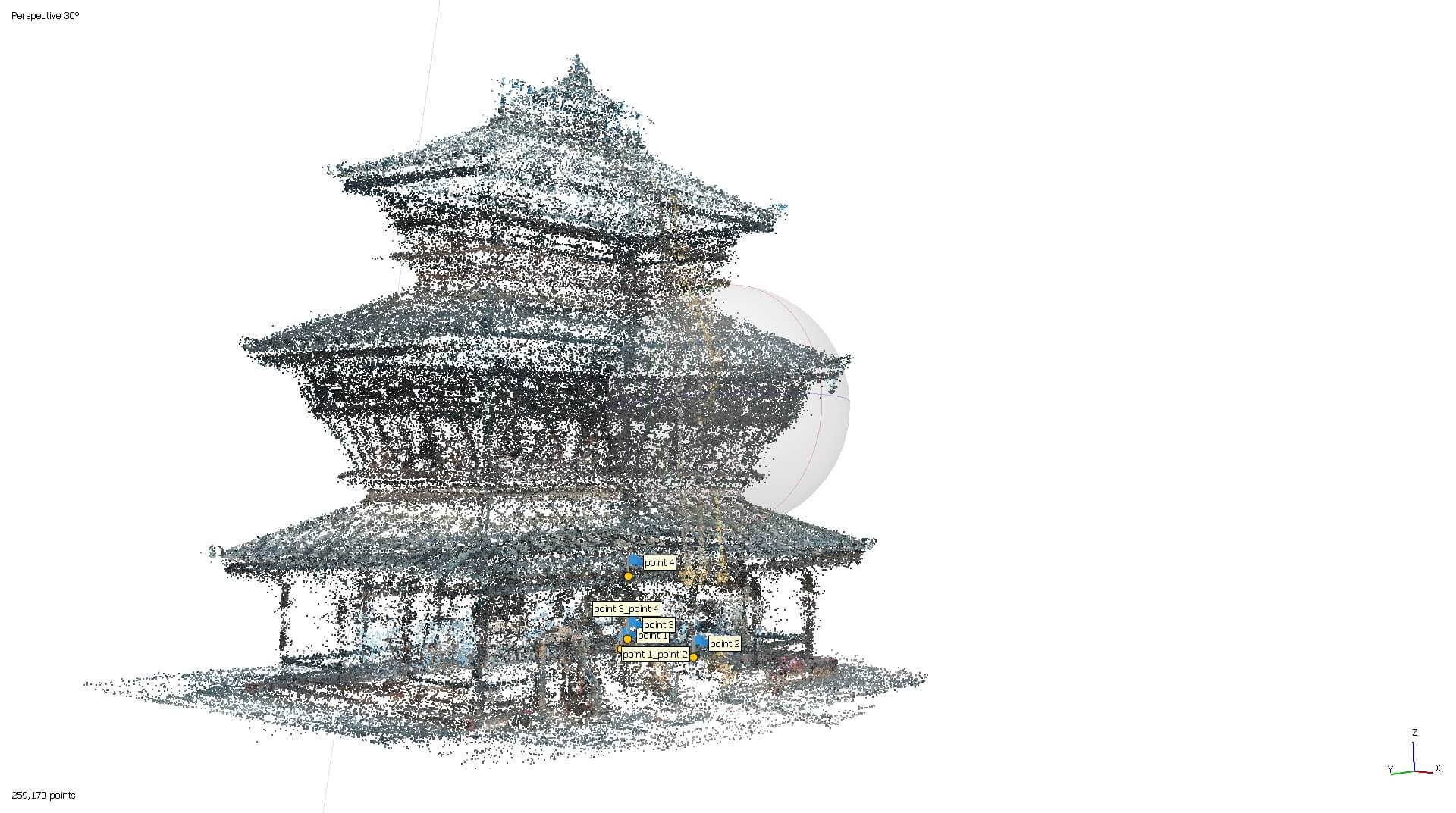
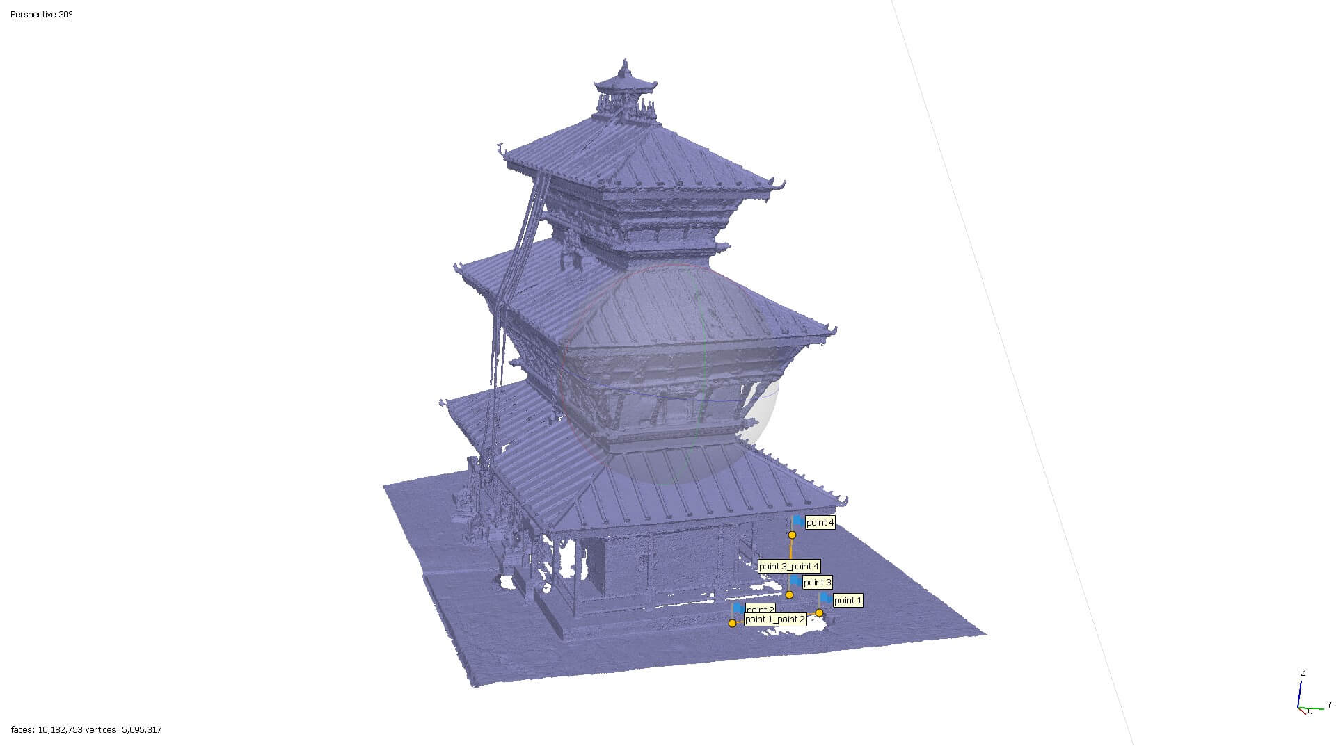
- 3D Reconstruction: Processed datasets in Agisoft Metashape to build highly accurate dense point clouds and 3D geometric meshes.
- Precision Scaling: Utilized 2m and 3m on-site surveying staffs to scale the digital model.
- Topographical Mapping: Generated and exported distortion-free, high-resolution DEMs and Orthomosaics.
- FEA Optimization: Executed strategic mesh decimation. Reduced polygon counts for Abaqus compatibility while preserving critical structural boundaries.
Key Achievements
- Achieved a final scale error of just 2.1 mm, delivering structural-grade accuracy without relying on standard Ground Control Points (GCPs).
- Successfully optimized ultra-high-density photogrammetry data for computational structural analysis.
- Captured and modeled intricate traditional Newari pagoda-style architecture.